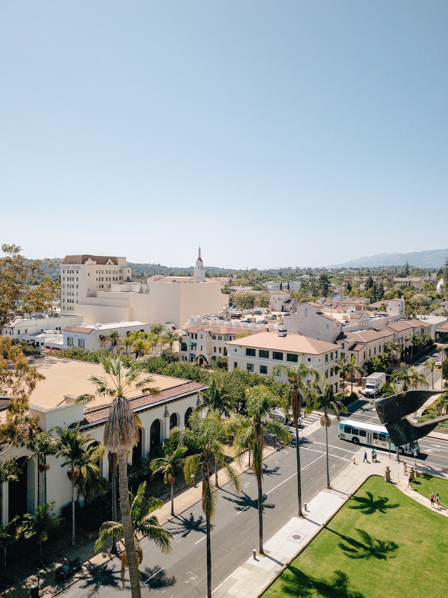
Santa Barbara is a beautiful coastal city located in Santa Barbara County, California. It is the county seat of Santa Barbara County and is known for its stunning scenery and mild climate. Santa Barbara is a popular tourist destination and boasts a variety of attractions, including beaches, parks, museums, and more.
Located on the coastline section which faces towards the south, the longest on the United States West Coast, the city lies between the beautiful Santa Ynez Mountains and the calming Pacific Ocean. With its warm weather and proximity to major metropolitan areas, Santa Barbara is a popular tourist destination year-round.
The city of Santa Barbara is known for its temperate climate which has been described as “Mediterranean.” The recognition of being the “American Riviera” was given to Santa Barbara because of its similarity to regions found in Europe. In 2020, the United States Census indicated that the population of Santa Barbara was 88,665.
Aside from being a famous resort and tourist spot, Santa Barbara’s economy is strong and prosperous due to its wide variety of sectors. The service industry in the city employs the largest number of people in Santa Barbara, followed by the education, technology, and healthcare fields. Agriculture is also an important part of the Santa Barbara economy, as is manufacturing and local government.
In 2004, the service industry of Santa Barbara’s economy employed 35% of the city’s workforce. This is due in part to the presence of four institutions of higher learning in Santa Barbara, which offer a variety of services to students and staff. These services include academic advising, tutoring, library and information services, career counseling, and more. As a result of the demand for these services, many businesses in Santa Barbara cater to the needs of students and staff, providing goods and services that support the educational mission of the city.
How to get to Santa Barbara
The picturesque city of Santa Barbara is served by the small yet easily accessible Santa Barbara Airport. Meanwhile, its train service is run by Amtrak, a passenger railroad service company that operates the convenient Pacific Surfliner that runs up the Californian coast all the way from San Diego to San Luis Obispo. Santa Barbara makes an ideal getaway destination, with its beautiful climate, stunning beaches and lovely architecture.
The Santa Barbara area is connected to Los Angeles via U.S. Highway 101, which is 100 miles (160 km) long. The journey from Santa Barbara to Los Angeles typically takes around two hours by car. Santa Barbara is also connected to San Francisco via Highway 101, which is 325 miles (525 km) long. The journey from Santa Barbara to San Francisco typically takes around five hours by car.
As you move away from the city of Santa Barbara and into the Santa Ynez Mountains, you’ll eventually come across the Los Padres National Forest. This forest has numerous remote wilderness areas that are perfect for exploring. If you’re looking for even more adventure, you can head out to the Channel Islands National Park or Channel Islands National Marine Sanctuary, both of which are located about 20 miles offshore.
Geography
Santa Barbara is a beautiful city located about 90 miles or 145 km in the west-northwest region of Los Angeles, along the stunning Pacific coast. This gorgeous stretch of coastline along southern Santa Barbara County is commonly known as “The American Riviera”.
The Santa Ynez Mountains are a dramatic east–west trending mountain range that rises behind the city of Santa Barbara, with a number of peaks that exceed 4,000 feet or 1,200 miles. The highest peak in the range is San Rafael Mountain, which reaches an elevation of 5,902 feet (1,798 m). Other notable peaks include: La Cumbre Peak (4,369 feet/1,335 m), Montecito Peak (3,1024 feet/931 m), and Antioch Dunes National Wildlife Refuge (2,683 feet/818 m).
According to the National Park Service, the Santa Ynez Mountains receive an average of only 10 inches of rain per year. Although snowfalls are not common, they do occur occasionally – perhaps once every three years. However, any snow that does fall quickly melts and is gone within a few days.
The United States Census Bureau reports that the city of Santa Barbara has an overall size of 42.0 square miles or 108.8 km2. Of this, 19.5 square miles or 51 km2 is land and 22.5 square miles or 58 km2 is water, making up 53.61% of the city’s entire area.
Geology and Soils
The stunning city of Santa Barbara is located on a coastal plain, nestled between the stunning Santa Ynez Mountains and the mesmerizing sea. This coastal plain has an intricate and varied range of alluvial deposits from the Holocene and Pleistocene periods, as well as estuarine deposits, debris flows, and marine terraces.
The alluvial and colluvial deposits are made up of materials that have been carried by water, while the marine terraces are formed from wave action on the coastline. The debris flows are made up of rock and sediment that have been transported down from the mountains by rivers, while the estuarine deposits consist of material that has been deposited in tidal areas.
The Milpitas series of soils are mostly well drained and consist of brown fine sandy loam. These rich, sandy loams are perfect for farming and gardening. They allow water to drain well and provide plenty of nutrients for plants to grow strong and healthy.
Geologic uplift is occurring rapidly in Santa Barbara, as demonstrated by the narrow beaches and coastal banks that can be seen along most of the area. The uplift is a result of tectonic activity in the area, specifically the movement of the Pacific Plate and the North American Plate.
Downtown Santa Barbara is situated on a coastal plain between two main geologic faults, the Mission Ridge Fault Zone to the north and the Mesa Fault to the south. This makes Downtown Santa Barbara vulnerable to flooding and earthquakes.
The main sedimentary bedrock segments underlying the coastal area are the Sisquoc Formation, the Monterey Formation, and the Santa Barbara Formation. In particular, the Santa Barbara Formation is a major unit in the aquifer that underlies the city. This aquifer is a vital water source for the city, providing water for both domestic and industrial use.
Neighborhoods
There is a considerable range of opinions when it comes to identifying neighborhood names and boundaries in Santa Barbara. However, despite these differences, there is still a general consensus amongst observers. This means that whilst there may be some variations between people’s perceptions of the area, there are still certain key features that are universally agreed upon. As such, Santa Barbara boasts a selection of neighborhoods with their own unique histories, architectures and cultures – making it an incredibly diverse and interesting place to live.
Included in this list are Santa Barbara’s most well-known neighborhoods as well as some that may be lesser known but no less important:
- The Mesa is a beachfront neighborhood in Santa Barbara, California that stretches 2.5 miles or 4 km from Santa Barbara City College in the east region to Arroyo Burro County Beach, which is also known as Hendry’s or The Pit to local citizens, in the west region. The Mesa incorporates a beach atmosphere with its nearby beaches of Mesa Lane and Thousand Steps, both of which offer beach access to residents and visitors.
- Bel Air and Alta Mesa are two of the most prominent areas of the coastal highlands in Santa Barbara, situated north of the Mesa. The region is mostly residential, with the Honda Valley natural area and Elings Park being the only exceptions. Elings Park is a remarkable place for being the biggest privately funded park in America.
- Mission Canyon is home to the beautiful wooded hills that start at Old Mission and extend along Foothill Road. This area is perfect for a nature lover, with plenty of trees and greenery to explore. You can also find Mission Canyon Road and Las Canoas Road in this lovely area. A popular destination for weekend hikers looking to explore the foothills, Mission Canyon is one of the most naturally beautiful areas of Santa Barbara. The dense natural vegetation makes the area especially prone to fires, but the views and hiking trails are well worth the risk.
- The Riviera extends for approximately two miles, with the north section stretching from Foothill Rd all the way to Sycamore Canyon Rd, and the south section extending from Santa Barbara Mission to North Salinas St. The Riviera encompasses an ocean-facing hillside as well as a back hillside, providing stunning views of both the ocean and the surrounding hills. Since the 1900s, it has been known as “the Riviera” because of its similarity to the Mediterranean coastal towns of Italy and France. The area is world-renowned for its azure waters, picturesque piazzas, and elegant villas that line the coastline.
- The Westside, or the area west of State Street, is mostly low-lying land between State Street and the Mesa. It also extends down to Cliff Drive and includes Santa Barbara City College. This area is predominantly populated and busy with many people commuting in and out every day.
- The Eastside, which is located east of State Street, mainly includes Santa Barbara Junior High School, Santa Barbara High School, and the Santa Barbara Bowl. This area is often referred to as the “east of State” area.
- The Waterfront area consists of a mix of commercial and tourist-oriented businesses along Cabrillo Boulevard, which includes popular destinations like the Santa Barbara Harbor, the Stearns Wharf, and the Breakwater. The area stretches eastward towards the Bird Refuge and west along the Shoreline Drive. The area is quite large and provides a great view of the SBCC campus below.
- Upper State Street is a lively and vibrant residential and commercial district that includes numerous professional offices, trendy restaurants, cafes, and much of the medical infrastructure of the city. Upper State is mostly defined by the area of the Granada Theatre and points Northwest. The location is home to many medical facilities as well as businesses ranging from small mom and pop shops to large corporations.
- San Roque is a neighborhood located to the northwest of the downtown area and north of Samarkand. It is known for being a culturally diverse and vibrant community with a strong sense of identity. The residents here are proud of their neighborhood and are very active in making sure it is a safe and welcoming place for everyone.
- Samarkand has been described as a “crossroads of cultures”, since a number of civilizations – including the Sogdians, Persians, Arabs, Turks, Mongols, and Russians – have settled in or near the city. Located in Santa Barbara, California. The area was originally settled by the Chumash people and later became home to a Spanish mission. In the late 19th century, it was developed as a residential suburb.


0 Comments