The Santa Barbara County including the Northern Channel Islands, has a long history of human settlement, with evidence of Native American occupation dating back at least 13,000 years. The region was first settled by hunter-gatherer groups who made use of the area’s rich natural resources, including its many plants and animals.
The area was home to the Chumash tribe of Native Americans for thousands of years. The tribe lived off the land and sustained themselves through hunting and gathering. The Chumash were a peaceful people who had a rich culture and were skilled in basket-weaving and canoe-making. They left behind many artifacts, including cave paintings, which can still be seen today.
The first European contact with the Chumash people occurred in 1542, when three Spanish ships under the command of Juan Rodríguez Cabrillo explored the area. This initial contact would eventually lead to the Spanish colonization of California and the decimation of the native Chumash population through disease and warfare.
In spite of the challenges they faced, the Chumash people survived and prospered. Today, thousands of Chumash descendants still live in the Santa Barbara area or surrounding counties. In 1901, a tribal homeland was established for them – the Santa Ynez Reservation.
Santa Barbara County has a long and rich history dating back to its founding in 1850. The county has undergone many changes over the years, most notably the division of its territory to create Ventura County in 1873. Today, Santa Barbara County is a vibrant and thriving community that offers residents and visitors alike a wealth of opportunities for recreation, relaxation, and exploration.
Geography
As reported by the United States Census Bureau, the county has a total area of 3,789 sq mi or 9,810 km2, of which 2,735 sq mi or 7,080 km2 is land and 1,054 sq mi or 2,730 km2, 27.8% of which is water. The county is made up of landmass equal to 2,735 sq mi or 7,080 km2 and 1,054 sq mi or 2,730 km2 of water bodies equivalent to 27.8% of the county’s total area.
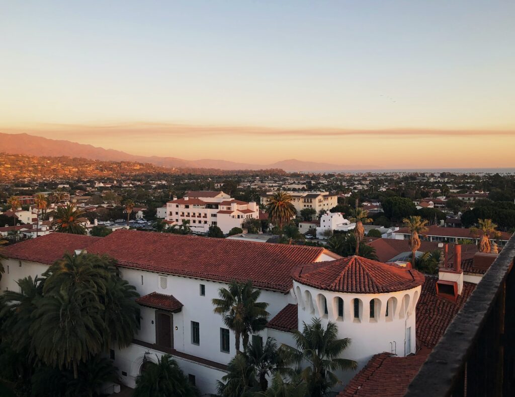
The Santa Ynez mountains act as a natural border between the southern coastal plain and the mountainous interior of Santa Barbara County. The majority of the county’s population is concentrated on the southern coastal plain, often referred to simply as the “south coast.” This area stretches from the Santa Ynez mountains all the way to the coast, and is home to many major towns and cities in Santa Barbara County.
The Santa Barbara area is made up of the cities of Santa Barbara, Goleta, and Carpinteria, as well as the autonomous regions of Summerland, Noleta, Isla Vista, Mission Canyon, Montecito and Hope Ranch. The towns of Buellton, Solvang and Lompoc are located north of the Santa Ynez range in the Santa Ynez Valley.
The independent municipalities of Los Olivos, Ballard and Santa Ynez can also be found in this area. Located in the northeasternmost point of the county are the small towns of Ventucopa, Cuyama and New Cuyama which are known for their agriculture and oil production.
Since January 1, 2006, Santa Maria has been the biggest city in Santa Barbara County in terms of population. This is due to the city’s recent annexations of surrounding unincorporated areas. Santa Maria now covers a total area of about 87 square miles.
The county is home to several major mountain chains, including the San Rafael Mountains, Santa Ynez Mountains in the south and the Sierra Madre Mountains in the inner and northeast area. These mountain ranges provide breathtaking views and are popular destinations for hiking, climbing, and camping.
The greater part of the mountainous region is located within the Los Padres National Forest, and encompasses two uninhabited zones: the Dick Smith and San Rafael Wilderness. These wild and remote locations are cherished by many for their unspoiled beauty and lack of development.
The highest ground in the county is 6820 ft. or 2079 meters at Big Pine Mountain in the San Rafaels. At this altitude, you can see some of the most amazing views which can go from miles and miles in every direction, and it’s truly a breathtaking sight.
North of the mountains lies the arid and thinly populated Cuyama Valley. The Cuyama Valley is located in both San Luis Obispo and Ventura County. This region is known for its hot, dry summers and cold, wet winters.
Most of the Cuyama Valley is made up of privately owned land mainly used for ranching, agriculture and oil production, The Los Padres National Forest sits to the south of the valley, while both north and northeast regions are owned by the Nature Conservancy and Bureau of Land Management.
Channel Islands
The Channel Islands in Santa Barbara County are home to native and endemic wildlife, including the island oak and Torrey Pine. The four islands namely San Miguel Island, Santa Barbara Island, Santa Cruz Island and Santa Rosa Island offers unique opportunities to explore and experience this diverse range of plant and animal life. Skunks are used to be found on San Miguel Island, but the continued predation from birds, foxes and marine life eventually led to their extinction.
Climate
Santa Barbara County generally has a mild climate, with warm summers and relatively cool winters. Along the coast, temperatures seldom exceed 100 degrees Fahrenheit in the summer usually don’t drop below freezing point in winter.
Although Santa Barbara County is located in a coastal area, temperatures on the innermost part of the region can still reach over 100 °F or 38 °C. At higher altitudes above 2,000 ft or 610 meters, the winter temperatures can occasionally drop below freezing.
It rains almost exclusively during the winter months in the area, with very little precipitation falling during the summer. The hot and dry summers in the area often mean that there is a high risk of wildfires in the fall. The lack of rainfall and the warmer temperatures create the perfect conditions for a wildfire to start and spread quickly. In the fall, when there is often a change in weather patterns, the winds can also play a role in fanning the flames of a wildfire.
This is exemplified by the Thomas Fire in December 2017. It started in Ventura County and quickly spread across southern Santa Barbara County. The fire grew rapidly due to high winds, eventually burning over 280,000 acres and becoming the largest wildfire in California’s modern history.
If you have been wondering where Santa Barbara County is located, we hope that this article has been of help to you. This place is situated on the Central Coast of California and it is renowned for its Mediterranean climate and beautiful beaches. The county seat is the city of Santa Barbara, which is also the largest city in the area.

0 Comments